Itinerary
Meet & assist at Queen Alia Airport by our representative and transfer to Petra.
Overnight in Petra.
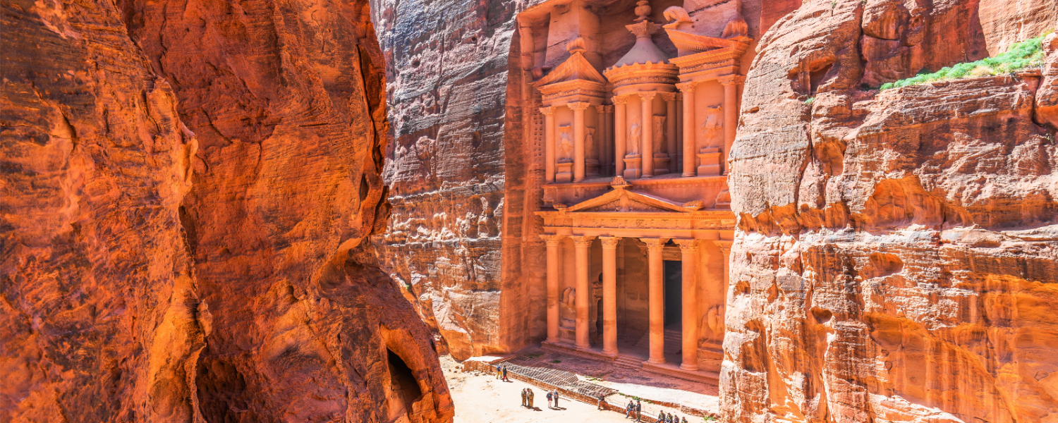
After breakfast, marvel at the beauty of the ‘Lost City’, the Red Rose City of Petra, exploring its many caves and tombs. Walk through the canyon and be astounded at the magnificent Treasury, the entrance guarding the ancient Nabatean city, now one of the Modern 7 Wonders of the World.
From the main site in Petra, we head out of the touristy parts of the city to the south through the sandstone hills. All around are traces of the Nabataeans with rock carvings and steps. Bedouins still live in the area. We reach the snake monument from where the fit and adventurous can take a side excursion to climb Jabal Harun.
The trail leaves the Jebel Harun trail, heading south out of the valley before descending into the upper reaches of Wadi Sabra with a wild mountain landscape ahead through which the trail finds its way for the next five days. Once in Sabra, the remains of a Roman theatre are passed near a spring with palms. The way then follows the valley easily down, alongside what is usually a small stream which eventually plunges into a box canyon above Wadi Al-Tibn. The canyon is bypassed by a shepherd’s path on its right that winds steeply down into the lower valley of Sabra. This is then followed for a further 5km before leaving it over low hills to camp on either side of, but not far from, the Rajif to Gharandal road.
After the previous day’s descent through the wild mountains overlooking more rugged and remote hills in the distance, the route now threads its way through them. From West of the road, descend West following Wadi Abu O’roug, which cuts its way impressively through Jabal Mriebed, sometimes in a narrow canyon necessitating a crawl to pass under boulders. After about 11 km you arrive at a junction with Wadi Huwwar and follow it up South to reach Wadi Al-Seif and camp in the middle of it.
Soon after leaving the camp, the trail rises to reach the head of Wadi Al-Seif then descending steeply to join Wadi Mshazza. Once again amid wild mountains, the trail now heads South over a low pass into the next valley, leaving that to cross another pass to reach the head of Wadi Gseib. This descends generally South before bending W to the next camp on a shoulder around 4 km from the road in Wadi Araba.
After retracing your steps up Wadi Gseib for about 1km, the route makes its way back into the mountains heading South East for about 3km through a beautiful colored sandstone Wadi, then descending easy cliffs and continuing South then South West across a sandy area into the wide valley of Wadi Al-Seeq. It then rises over and crosses an expanse of dunes, descending into Wadi Rakiya which joins Wadi Aheimir 1 km South West. Nice camping area with dunes a little further on above the West side of Wadi Rakiya
Another splendid day on the trail following the increasingly awesome canyons of Wadi Aheimir, first heading South South East with its surrounding cliffs rapidly closing in to reach a fork in the wadi after about 4.5 km Ignoring the obvious continuation to the South, head almost East through about 16 km of canyons. (Beware of flash floods and be prepared to cross pools and scramble up boulders.) The last 7 km of these canyons have numerous side canyons so it’s essential to take care of route finding in this impressive place which often has 200m walls on either side and is sometimes only a couple of meters wide.
Finally, not long after passing a recent rock fall a path rises to the East to escape from the clutches of the canyon onto a barren plateau not far from a small village called Abbasiya.
4.3 km South West are the ruins of Humaima, with its sophisticated water supply system.
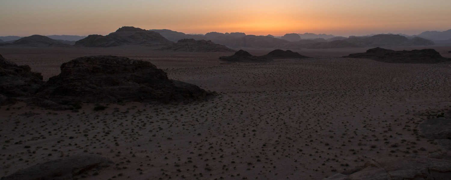
The route goes across fairly flat terrain in the direction of the mountains of Wadi Rum. We head towards modern Humiema which is now on the Desert Highway; with a chance to buy water and supplies. We cross the highway and start heading across the sands with increasingly large sandstone outcrops dotting the landscape.
Head generally south from the camp, crossing mud flats and passing under the Disi road before joining the Rum Visitor Centre road. (Visit the Centre for tickets, also shops, café etc.) Then head down the spectacular Rum Valley towards Rum village which is visible on the horizon, under the huge cliffs of Jebel Rum. If you stay left (E) close to the huge mountain of Jebel um Ishrin there is optional shade and a chance to see Thamudic period inscriptions on the big rock of Dims Hajaj. Further on, at the foot of the screen, you may find Neolithic upright stones forming squares of unknown purpose. In the mouth of the huge Makhman canyon, there is a large granite boulder called Musa’s Slab, popular with climbers, after which the village is soon reached. (Rest House, shops, cafés, camping, homestays, and “some of the world’s best desert climbing”)
After breakfast, transfer to your last destination in Jordan, or we can customize any tour you like.


